Please note: Design details in next post!
__________________________
Wayfinding
(A comparison on 2 sites)

&

Left | High Cross Park
Right | Railway Square
(yellow arrow is only pointing to the word. Site is within blue triangle)
I'm choosing Railway Square as a comparison as it is a 'large bus terminus'* and it has a lot of the facilities/amenities mentioned in table 4-1 transport guidelines for a bus-light rail interchange.
*Source
www.en.wikipedia.org/wiki/Railway_Square,_Sydney (accessed 29/5/14)
(not the most credible source. Apologies)
On a very simple glance, High Cross Park and Railway Square are similar in terms of configuration
- Both a triangular site
- Both have a busy main road | Avoca St & George St
- A less busy road | Belmore Rd & Lee St
I was on site firstly at High Cross Park and had a look at where pedestrians walked to and from (there weren't too many people at the time) and did the same with Railway Square afterwards.
__________________________
High Cross Park
Pedestrians mainly walked back and forth along Avoca St shopping strip and a few people down Avoca St along the footpath in front of the hospital.
A few people sat down on the park to eat (a family and possibly two hospital workers).
**These are photos that have been digitally zoomed in. Original photos were taken from a distance away!
A few bicycle riders (3) rode down either from Avoca St along Belmore Rd or vice versa.
The majority of the traffic flowed along Avoca St and some traffic along High St-Belmore Rd.
Note: This is from 15-20 minutes on being on site and does not reflect the conditions of traffic of all times during the day and week.
__________________________
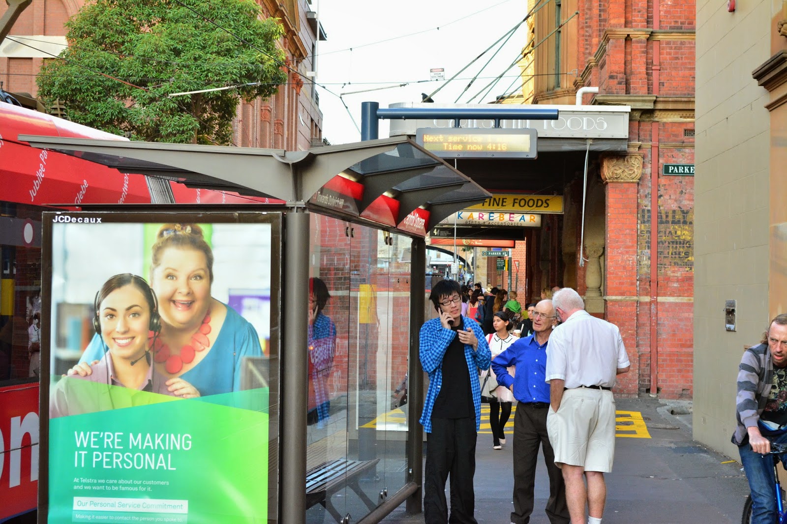
Railway Square
Pedestrians mainly walked along George St with small crowds waiting within Railway Square for buses (this was about 3-4pm). A smaller amount of people waited on Lee St side of Railway Square for buses.
Left | George St crowd
Right | Lee St 'crowd'
(a bunch of people just boarded the bus before that photo!)
There was 1 or 2 bicycle riders along George St that used the bus lane (on the Ultimo Tafe side).
In terms of traffic most of them flowed along George St and to a lesser extent Lee St.
On Lee St I noticed taxis stop behind buses for pickup/dropoff (as depicted in the right picture above)
Please note: This is my interpretation of information from being on site on a given day and may not entirely be correct on a day to day basis (eg. with traffic flow, pedestrian paths etc).


-2.jpg)